


Slick & Lyle’s Barbershop: Honoring Family Ties
June 2025
FIRST PERSON: Wade Hampton – Chief Meteorologist, KPLC-TV
June 2025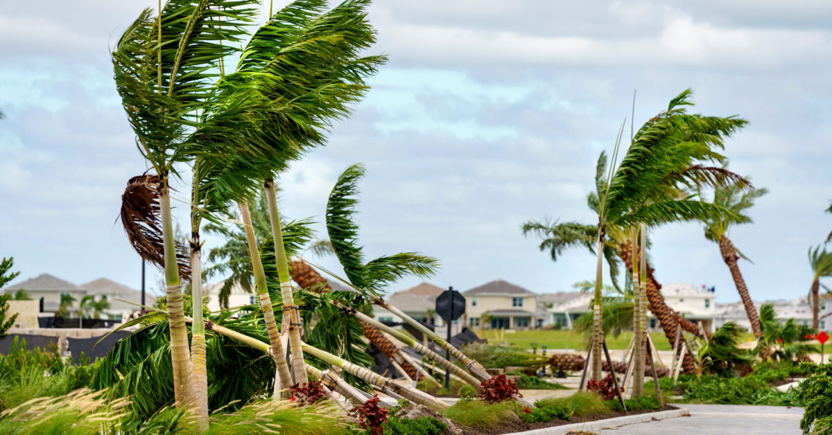
by Kerri Cooke
School’s out, the sun is shining and you’re getting ready for summer vacation. Things are great… until you watch the weather forecast and see there’s a potential storm brewing in the Atlantic Ocean, Caribbean Sea or Gulf of Mexico/Gulf of America. Here’s what forecasters are predicting for 2025’s hurricane season.
Colorado State University produces one of the most trusted hurricane forecasts every year. This year’s forecast notes the potential for a slightly above average season. While fewer storms are expected to form than in 2024, the difference in the numbers is small. Colorado state predicted 18 named storms for 2024 while they’re predicting 17 for this year. 11 storms were expected to become hurricanes compared to nine in 2025. The formation of major hurricanes, category 3 or higher, is down one at four. Florida and North Carolina are expected to be at greater risk for hurricane landfall over the summer. This is a forecast which takes environmental conditions into account to make an educated guess on what will happen in the open waters later this year, but it is by no means certain.
While NOAA didn’t release their forecast in time for Thrive’s deadline, Donald Jones, meteorologist for the National Weather Service in Lake Charles, provided some insight into the conditions expected throughout hurricane season.
While hurricane development relies on a number of factors, warm water is fuel for storms. Colorado State says while waters are warm, they are not as warm as last year and the water in the Main Development Region (MDR) in the north Atlantic is a littler cooler than usual.
Jones said the air temperature near the coast has a direct impact on how hot the water in the Gulf gets and notes the cool air we’ve received through mid-May. However, he says, “There only needs to be a water temperature of 80 degrees to get tropical development.”
Another factor that affects the birth of hurricanes is Saharan dust, which Jones noted is a pretty common occurrence early in hurricane season. Think June through July. Saharan dust traveling across the Atlantic and into the atmosphere in the United States can tamp down tropical development for weeks at a time. It does so by drying out the air and blocking some radiation from the sun, which in turn can cool ocean waters. Jones noted that while Saharan dust can temporarily inhibit tropical activity, it only does so for a short time. Once the dust settles, hurricane development can ramp up quickly.
You’ve likely heard about El Niño and La Niña and how these weather patterns are big determinates as to how bad a hurricane season is. Jones said weather patterns will be neutral as we enter hurricane season. Neither El Niño or La Niña will be prominent, but that could change later on in hurricane season. El Niño helps suppress hurricane development, while La Niña can aid it by reducing wind shear. If the pattern flips to La Niña later in the season, we can expect a greater number of hurricanes to form than if the environment remains flat.
There’s been a lot of attention on the danger of rapid intensification over the last few years as a big risk with storms in the Gulf. However, Jones emphasized that a lot of factors have to be just right for such a phenomenon to happen. A storm needs a significant amount of warm water, low wind sheer and certain characteristics for rapid intensification to occur. Landfall along Caribbean islands or the Yucatan Peninsula can also decrease a storm’s ability to rapidly intensify. While Jones said we have seen more storms undergo this pattern in the last decade, it’s still too early to determine “if it’s a new normal, a phase or coincidental.”
One thing is for certain, though. Hurricane formation will happen, so stay weather aware and make sure you and your family are prepared in the event a hurricane threatens Southwest Louisiana.

